Showing posts with label Great Smoky Mountains. Show all posts

Wednesday, February 10, 2016

A Fine November Day (in December) Part 1 of 4


Sometimes November just hangs around for two or three extra weeks, all the way up to Christmas, giving us a few, delicious weeks of sharp, blue skies and mild temps for cutting one more rick of firewood, raking the last of the leaves, or taking a glorious stroll in the mountains. While cutting wood and raking leaves are pleasant enough activities, they are both “work” by any reasonable definition, so I opted for the mountains, which can be work, but only in the very best sense of the word. And besides, I’d been acting like a well-adjusted grown-up for several weeks in a row, and I’d had just about all I could stand.

One benefit of a November hike – especially if it happens in mid-December – is the deep, deep blue sky. I imagine folks who live in the Rockies are used to those blue skies that are so crisp they look like they could shatter because there’s not much humidity to muddy up the atmosphere and the views, but here in the East we have to wait for fall and winter for our sky to change from white to blue.

An added benefit of a cold weather hike is that if you can spend the day on a south-facing slope, you can add 10 or even 20 degrees to the temperature… as long as you stay in the sunshine. For example, much of Alum Cave trail is on the south-facing slope of Mount LeConte, but there’s also a lot of deep shade. So you can stroll pleasantly along in the warmth of the sun on an ice-free trail, only to walk into the shade of a spruce grove and find yourself slipping and sliding on an icy patch 10 or 20 or 100 feet long. If you do this enough, you get used to it and take it for granted. But then the day comes when a friend of yours is looking at the pictures of your December LeConte hike, and they innocently ask why you are wearing spikes on your boots but only a T shirt with no jacket. The incongruity of spikes and a T shirt has never occurred to you, but it really is an odd combination that makes sense only to those who hike on south-facing slopes in the late fall. (Of course, you’ll explain to your friend that the top of LeConte is cold and windy and your jacket is in your day pack. You’ll definitely need it when you get to the top.)

So as our schedules opened up in mid-December, Greg Harrell and I decided to do an off-trail trip up Styx Branch on the south-facing slope of Mount LeConte. We love the name Styx because it gives the impression of a dangerous, deadly, one-way journey filled with dragons, demons, fire, weeping, and gnashing of teeth. To make things even better, the general area where Styx Branch flows is called Huggins Hell. Names like that are like a flashing neon sign begging us to visit.

For purposes of full disclosure, I might as well admit up front that the names Styx and Hell are creative hyperbole generated by an over-active imagination, or something like that. The story goes that a guy named Huggins got lost in the thick rhododendron hell in this Styx Branch watershed. One version of the story says he emerged three days later, exhausted and near-death. The other version says he never emerged and was never found. I just can’t bring myself to believe any of it. The only person who could truly get lost up there is a delicate city-slicker who has no idea what he’s doing. If Huggins was a local resident who got lost, all he needed to do was find a ravine with some trickling water, and follow it down to the main river, which led to the homes and farms of Sugarlands and eventually to Gatlinburg. The whole process of getting from the rhododendron-infested slopes of LeConte to Sugarlands would take 3 or 4 hours. I suppose Huggins could have slipped on a rock and broken his leg or neck, in which case he died not because he was lost but because he was clumsy, or just plain unlucky. [To be continued]

Monday, December 29, 2014

The Land of Sharp Edges (5 of 9): The Jumpoff Cascade


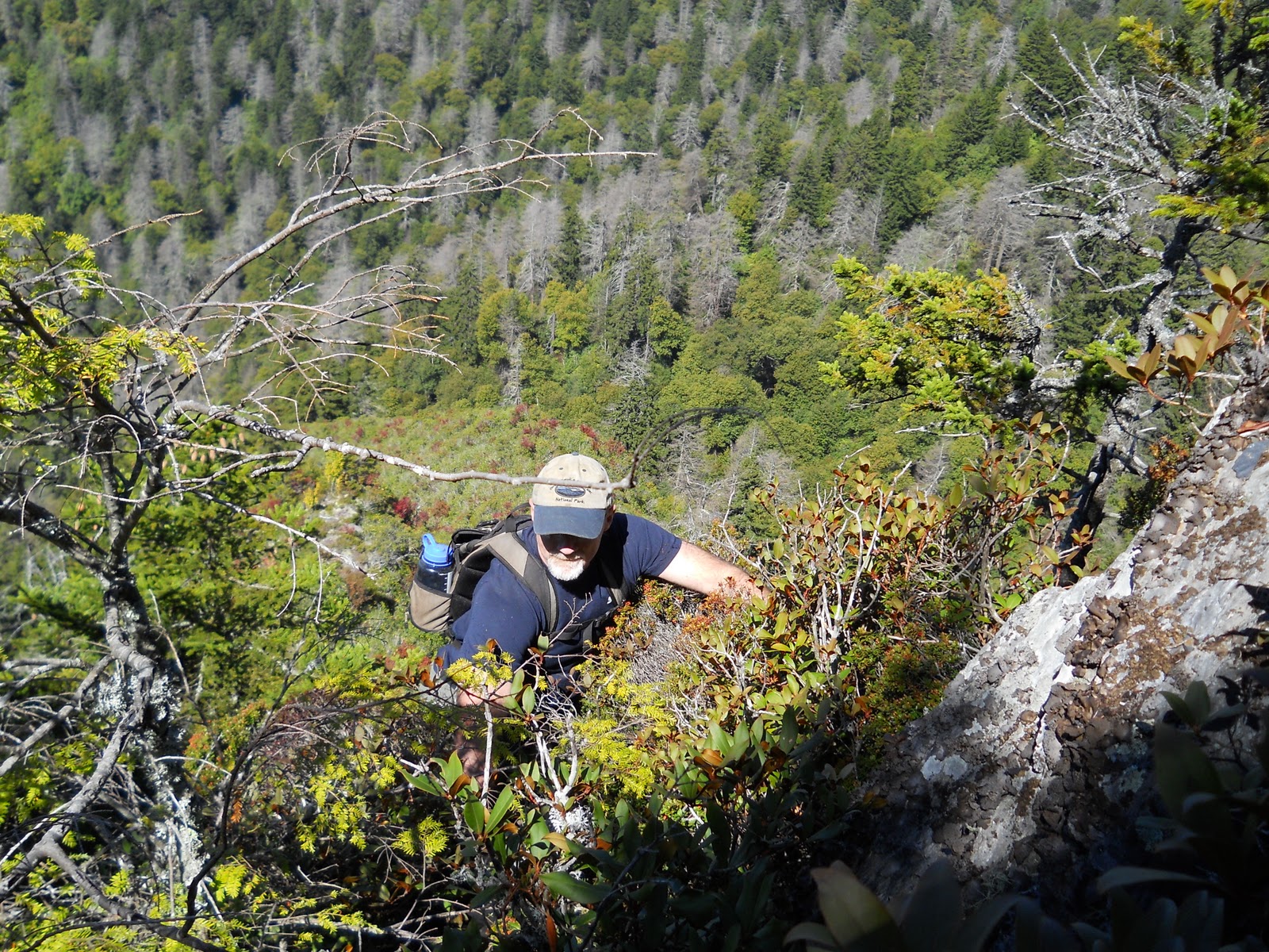
As we worked our way up the Jumpoff, we spent more time in the moss and bushes than we spent in the creek because the creek was now a long, winding cascade which was too steep and slippery for us to trust. Only occasionally could we get in it and climb directly on its rocky path and even then only on segments that were ten or twenty feet high – if any higher, a slip and slide would be long and painful, maybe deadly.

The result was a long, slow ascent as we grabbed and pulled and pushed and rested. Repeat, repeat, repeat. The next day, as I recuperated from our adventure, my legs and arms were a little sore, but the body part that suffered the most was my fingers. The muscles in my fingers were almost too sore for me to grip door knobs, write with a pen, and type on a keyboard. I’ve never seriously pondered the fact that there are muscles in our fingers, and to the best of my recollection I’ve never done any activity that actually made my finger muscles sore… until the grabbing and pulling of this trip. From now on I guess I’ll have to put finger exercises into my workout routine; although, I have no clue what kind of exercise to do to get a good finger workout; maybe kneading bread dough or digging in sand. Is there such a thing as finger curls? It’s a question that personal trainers probably aren’t asked very often because finger muscles aren’t glamour muscles. Rock climbers, on the other hand, would know the value of a buff hand.


This was the first trip on which I wore gloves. A couple of recent, off-trail trips had resulted in some damage to my hands and wrists. I normally get some bumps and bruises, but on one of these trips I had managed two good cuts on my hand and wrist. I don’t know how I got them. In fact, as I recall, Charlie and Keith asked where I got the bloody cuts, and I couldn’t tell them because I hadn’t noticed until they pointed them out. Although, I suppose I would have noticed sooner or later because one of them wouldn’t stop bleeding. As a result, I have some good pictures of me wearing a blood-stained shirt. It looks worse than it really is which is the way I like things to be – that is, not as bad as they seem. The cut on my wrist didn’t bleed a lot, even though it was deeper and longer. In fact, Keith called is a “laceration” which had a nice, manly ring to it, but again it sounded worse than it really was.

So, after that trip, I began wearing gloves on some of these off-trail jaunts. Some guys wear stout, sticky gloves like NFL receivers wear, but I opted for a $13 pair of leather work gloves from Wal-Mart, and in this case that seemed somehow appropriate. Not only were these gloves less expensive, but they had a simple “going to work” appearance that I kind of like because some of these hikes are a lot like work, even to the point of looking forward to quitting time when you can go home and take a shower. My hiking partners use headlamps on our night hikes and Charlie wears protective goggles on some of these trips, so between headlamps, goggles, and gloves we look like a gang of laborers heading down into the coal mines. All that’s missing are lunch pails and hard hats.

This cascade, which we now call the Jumpoff Cascade, went on and on and on. One hundred feet, two hundred feet, one football field. More climbing. Four hundred. Five hundred. Two football fields. More climbing. Seven hundred. During the climb we didn’t know exactly how long this cascade extended, but we made a pretty good guess based on elevation and angle. Greg, Keith, and Charlie all had altimeters which measure elevation using barometric pressure. Their equipment all pretty much agreed that after 1,000 feet of vertical elevation gain, we came to a split in the cascade. We had ascended vertically 1,000 feet at roughly a 45 degree angle, which would mean our horizontal distance was about 1,000 feet as well. Using the old Pythagorean Theorem from high school geometry class for calculating the hypotenuse of a right triangle, we came up with an estimate of about 1,400 feet. Up to this point, this cascade – which still continued up both of these small forks at this junction – was 1,400 feet long!


To grasp the significance of that, consider that Ramsey Cascades, one of the most popular waterfalls in the park, is about 100’ high. Abrams Falls, another visitor favorite, is about 30’ high. Yes, these two waterfalls have much greater volume and width than Jumpoff Cascade, which at this high elevation is generally just a heavy trickle… but 1,400 feet for cryin’ out loud! And it continues another one or two hundred feet up both of these upper forks on Mount Kephart.


It’s discoveries like this that make hiking in the backcountry really special. There are hidden, rarely-visited waterfalls and cascades all over the park: Mill Creek, Upper Ramsey, Cannon Creek, First Trib. They are everywhere, and in terms of sheer length, Jumpoff Cascade dwarfs them all.


Thursday, September 1, 2011

Those Dark, Dirty Shelters (1 of 7 on the AT)


Let’s spend a few weeks talking about the Appalachian Trail, one of America’s best ideas. The AT stretches about 2,170 miles from Springer Mountain in north Georgia to Mount Katahdin in central Maine. You can hike on it for free. For almost its entire length you can hike and camp without any special permits or paperwork – a remarkable accomplishment considering it’s officially owned by the mother of all bureaucracies, the US government. You don’t have to report in to anyone in a uniform or a dark suit and tie. It’s the epitome of life, liberty, and the pursuit of happiness.

Except for the 72 miles of the AT in the Smoky Mountains.

The Smokies are such a revered location among AT hikers that they could easily be loved to death. It’s a Tragedy of the Commons waiting to happen. So, the government has stepped in to stem the tide of mountain lovers.  

Fortunately, the park is administered by what may be the last, sane department of the US government – the National Park Service. I’ve had numerous encounters with park rangers, volunteers, and other staff persons, and 95% of these moments have been pleasant. The good guys haven’t been chased away yet by whatever it is in bureaucracies that squeezes the spark of life out of its employees.  (Now that I’ve said that, I must admit that the folks at our local post office are great, too. One more reason to live in a small town.)

I should also add that there’s a significant group of folks in the Bryson City area who would disagree with my assessment of the NPS – they are mad about Fontana Lake, the Road to Nowhere, restrictions on bear hunting and ginseng digging, and just about anything the NPS does. Some of them are reasonable people and some aren’t. But I digress…

Even the NPS hasn’t been able to avoid that essential part of every bureaucracy – paperwork. To day hike in the park, just find a trail and go. No paperwork, no permission slips. However, if you want to camp overnight in the backcountry, you’ll have to fill out a permit. (No fees yet, but they are talking about it.) When you arrive at the park, you must find a ranger station and spend five minutes filling out an itinerary. That’s it. Five minutes. Stop for a moment and let that sink in. A five minute encounter with the Federal government. To get the full impact of that, stop for a moment and think about what you were doing on April 14.

If you camp on the AT in the park, you’ll be staying in a rock and log shelter with a tin roof. These shelters are heavily used, and they do show some wear and tear, but even the wear and tear is a reminder that you are doing something that people have been doing for several generations. And people will continue to do it long after you are gone. You are a link in a long chain of main crest hikers. It’s enough to tempt you to carve your name on the old log rafters. (Please don’t.)

Several years ago, a guy named Bill Bryson wrote a book called A Walk in the Woods. He and a friend, both novice backpackers, decided to hike the entire AT from south to north. To make a long story short, they limped and whined all the way to the Smoky Mountains. Once there, they didn’t like the “dark and dirty” shelters, so they quit hiking at Newfound Gap, caught a ride to Gatlinburg, ate some cheeseburgers, then drove to Roanoke, VA. They skipped the eastern half of the Smokies, all of Tennessee, and much of Virginia! I was so disgusted that I quit reading. I don’t know and don’t care how the book ends, but I hope at some point they came to grips with the reality that if you hike the AT, you are going to get wet and dirty, and the accommodations are somewhat primitive. That is, after all, the point.

So call these shelters dirty and dingy if you want to. I call them rustic and quaint. Not in an antique shop way. More of an old barn way. They are drafty, uncomfortable, and crude. They have mice and skunks, and an occasional bear. In other words, they are great, perfect – exactly what you’d hope for on a backpacking trip in the mountains.

Tuesday, March 8, 2011

Albright Grove: No Tree Lives Forever (Part 2 of 2)

As Phyllis and I walked through Albright Grove I wondered why this piece of virgin forest didn’t look established and mature, like a 300 year old cathedral.

After some rumination and a few conversations with a few folks who might know, I think I know at least part of the answer. Albright Grove has been slowly, invisibly “logged.”

Some of the logging has been the result of old age. Some trees species will live longer than others, but no tree can live forever. Throw pollution, lightning, wind, and drought into the mix and the result is an old forest with many dead, dying, and broken trees.

Other loggers were small and secretive. They snuck into our forest before we realized what was happening, and once we discovered their covert activity, it was too late. We were defenseless against their attack. This happened in the 1930s when the Chestnut blight (fungus) swept through the eastern US and wiped out virtually all of what had been one of the dominant trees in the East – the American Chestnut.

It was a biological and economic disaster for the animals and the people, both of whom depended on the chestnuts for their life and livelihood. Of course, the forests suffered, but as any biological community will do, it readjusted, filled in the gaps, and flourished in a different form. Where chestnut once dominated, we now see poplar, maple, oak, and hickory.

This tragedy happened about 75 years ago, which is a long time in human terms but not in forestry terms. The death of the chestnuts opened up the forest canopy. The sunlight shone down on the long-shaded forest floor, and the fight was on! Flowers, shrubs, and trees vied for position, creating a botanical chaos for a few years. Gradually, the trees grew up to take the place of the American Chestnuts, but the process is still unfolding. The deep, deep shade of a mature forest is still missing. The massive trunks of ancient trees are missing – except for the few, scattered giants still hanging on in Albright Grove and other portions of virgin forest in the Smokies.

What’s really going on here is the difference between a climax forest and virgin forest, two things that would often be the same thing but not always. Not in Albright Grove.

A virgin forest is one that has not been logged. It is untouched by man. This creates images in our heads of deep, dark forests of huge, old trees. An eastern, hardwood version of those huge, open redwood and sequoia forests of the Pacific coast. What we are visualizing is actually a climax forest – that ultimate stage of a centuries-long process of plant succession. It’s plant succession that is still unfinished in the disturbed forest of Albright Grove.

Plant succession is an interesting process. You see it every September as your family’s vegetable garden winds down for another year, and the grass and weeds creep in. You see it whenever a farmer stops tilling or cutting his field. Almost immediately weeds and shrubs begin their invasion, followed quickly (here in East Tennessee) by the cedars and pines. These are the “pioneer species” because they are the first to arrive. Interestingly, these pioneers create the conditions for their own demise by creating shade and soil changes that enable other species to grow. If the land is sunny and dry then the pines will dominate. If the location is moist and cool then after a few decades, hardwoods will replace the pines. The only question is which species of hardwood will win the battle – Maple? Hickory? Oak? That, too, depends on elevation, moisture, soil type, plus a little bit of random luck.

It’s an evolution of sorts but not the type that Darwin wrote about. It’s not the evolution of a species; it’s actually an evolution (or “development,” if you prefer that word) of the relationships between species. If this was a human community, it would be studied by sociologists, but since it’s plants and animals, the folks who study it are ecologists. Either way, it’s a community that is developing, a botanical and zoological community.
This process of plant succession continues for hundreds of years until this forest community reaches maturity, the climax, usually a deeply shaded forest with a high canopy and shade-loving plants on the forest floor. It’s the cathedral that Phyllis and I were expecting as we stepped off Maddron Bald Trail and onto Albright Loop Trail.

So now, with your expectations adjusted – not necessarily lowered, just adjusted – you can spend four or five hours enjoying the beauty of this part of the park. Go and enjoy this old, virgin, evolving forest. Just remember that it’s a changing forest community, not a cathedral. At least, not yet.

Monday, February 14, 2011

National Park Hyperbole (Part 1 of 2)

Every now and then, something unusual happens: my time in the Smokies doesn’t live up to my expectations. That happened to me recently in Albright Grove.

If there’s one lesson I’ve learned over the years, it is this: the secret to happiness in life is lowering your expectations. I usually say this as a joke, and yet it’s amazing how often it fits the circumstances, on an almost daily basis. Job, sports, health, relationships, teenagers, our political leaders… the list goes on. So maybe it’s not a joke after all. There must be some truth to it. If you aren’t convinced, consider the Vols’ last few football seasons or your 401(k).

Maybe Albright Grove belongs in this list…

After buying some apples and honey at Carver’s Applehouse in Cosby on a crisp October Saturday (very early October, before the deluge of leaf-watchers struck), Phyllis and I turned onto Baxter Road and wound around to the trailhead of Maddron Bald Trail. There’s room for only 3 or 4 cars here, but today that was plenty. So we shouldered our daypacks and walked past the gate and up the trail. Up is the right word here, but with no exclamation points or capital letters. This trail is wide and well-maintained, and its incline is unrelenting but “moderate,” to quote the trail guide. Yes, it’s that 500’ rise per mile that is very common in the Smokies. That was clearly the gradient of choice in the 1930s when the CCC built these trails. I’ve sometimes wondered if the trails were being built today whether the builders might choose a milder incline because we are today a softer, more delicate people than 75 years ago. Still, 500 feet per mile is manageable, even for those of us who were born in the mid 20th century.

Phyllis and I moseyed our way up the trail, stopping often to examine flowers, leaves, stumps, red squirrels, juncos, even an old cabin. As usual, the surroundings were pleasant. The weather was fabulous. The occasional glimpse of nearby mountain tops showed that the colors of fall were just beginning the show at the highest elevations and would spend the next few weeks marching gradually down the slopes.

Our goal this day was Albright Grove, a portion of the park that is described in some of the park literature as a magnificent section of unspoiled virgin forest that escaped the logger’s axe. I don’t know what you visualize when you hear that, but I visualized a deeply shaded, mature forest with a high, thick forest canopy held aloft by huge trees. It would give the feeling of being in a cathedral with a high, vaulted ceiling. There would be some underbrush, but the shade would have choked out much of it. There would be a sense of openness and depth and peace. As one book says, “Being in the Albright Grove has the kind of effect that lingers in your memory for instant recall, soothes the spirit with profound quiet, gives nourishment to the soul.”

Okay, everyone is entitled to their opinion… and my opinion is that it’s time to lower your expectations. Most of those folks who have written glowing reports of Albright Grove have fallen victim to that dreaded disease – National Park Hyperbole. Its primary symptom is verbal exaggeration. It’s an affliction much like alcoholism or pollen allergies: once you’ve been stricken, you will battle it your entire life, sometimes resisting, sometimes succumbing. If a writer describes a view as “the best” or “the most dramatic” or some such superlative, you can be confident that he’s suffering from a case of NPH. Albright Grove seems to be a spot that triggers serious outbreaks of this affliction.

First, the huge, old trees. Yes, there are many bigger-than-average trees – the largest of which are sickly, some almost dead. I don’t mean to be crass here, but Albright Grove felt more like a nursing home than a cathedral. Those old, old trees surely had some stories to tell, probably going as far back as the Revolutionary War, but they seemed too sick to open their eyes and speak.

That’s not to say that the entire forest was sickly. On the contrary, it was, for the most part, healthy. That’s because most of the forest was young with various species of trees still struggling with each other for dominance. As we walked through the Grove I wondered why. Why not an old, established forest? Why not a cathedral? [To be continued]

Wednesday, January 19, 2011

Peregrine Homecoming (Part 3 of 3)

When I first heard the name “duck hawk,” I visualized some sort of hybrid bird – a mix of a hawk and a duck. It’s not a very majestic image – maybe a hawk with a big, Daffy Duck beak or a big butt better suited for floating than soaring – but all that changed when I learned that “Duck Hawk” is just a quaint, old name for a peregrine falcon. I didn’t know much about falcons, but my image of them was sleek, fast hunters who live by catching and killing other animals. That put them in the same category as eagles and hawks which is pretty elite company if we’ll ignore the fact that eagles frequently feast on dead, rotting fish, the aquatic equivalent of roadkill.

There are three main falcons in the eastern US: American kestrel, merlin, and peregrine falcon. These three are sleek, modest-sized birds with black-and-white face markings like the rock band Kiss. The kestrel and merlin are about the size of a blue jay while the peregrine is about six inches longer, about the size of a healthy crow. I’ll occasionally see an American kestrel sitting on a power line overlooking a field. They have rusty-orange colored backs and those distinctive Kiss face markings. Merlins are rare in our area, passing through occasionally during spring and fall migrations.

Peregrine falcons are permanent residents in the eastern US. In fact, they are permanent residents across almost the entire planet, being one of the most widely distributed animals in the world. But that doesn’t mean they are common. There are only three well-documented, breeding pairs in Tennessee: one on Little Duck Hawk Ridge, one near Charlies Bunion, and another pair at the Chickamauga Dam in Chattanooga. (Personally, I’d bet there are one or two more couples in the Smokies that the NPS isn’t telling us about to protect their privacy.) The owners of Rock City are participating in a falcon “hacking” (the release of captive falcons) program at Lovers’ Leap, so if that project is successful, it will give us another reason to See Rock City.

Ironically, aside from the banning of DDT, the other factor that has strongly contributed to their comeback has been big cities with tall buildings. For example, the first nesting pair of peregrines in the state of Ohio was found in Toledo in 1988; afterwards, they spread to Cincinnati and Cleveland. Chicago and Indianapolis both have peregrine families living in their downtown areas. Not very inspiring stuff. In my mind, that diminishes the glamour of these birds a bit because they appear to occupy the same environmental niche as pigeons, their favorite food.

I’d prefer that they live only in wild, lonely places that are hard to find, but that isn’t how Mother Nature and urban architects wrote the script. They nest on rocky cliffs and ledges, but apparently the concrete walls of bridges, dams, and skyscrapers fit that description well enough to satisfy the falcons. The fact that cities lack the primary predator of falcon chicks – the Great Horned Owl – also makes high-rise, urban areas favorable falcon habitat.

Beside their near extinction, peregrines’ other claim to fame is their speed. On a good, downward dive toward their prey, they can reach speeds of 200 mph, making them the fastest animal in the world. In the wild, these falcons will swoop down like a dive bomber and crash talons-first, mid-air into their prey. They seem to prefer birds that fly in flocks rather than alone, so it’s like shooting fish in a barrel, which isn’t very sporting but is ruthlessly efficient, which is what falcons do.

They have been captured and trained for at least three thousand years, and in the days before guns, they were a useful way of hunting birds. During the Middle Ages in Europe, falconry became “the sport of kings,” a form of entertainment for the elite, perhaps arising from the fact that falcons would sometimes nest on the walls of Medieval castles and cathedrals; although, the fact that only the wealthy nobility would have the leisure time to pursue sport of any kind would also have been part of the equation. So, in spite of their penchant for eating urban pigeons, they do have a trace of nobility in their blood.

So, as we stood at a wide spot on Big Duck Hawk Ridge, looking upon the southern slopes of Mount LeConte, near Peregrine Peak, the Duck Hawks made their appearance. The entire show lasted only 5 minutes, but it was the grand finale to an already fine day. We had grandstand seats for a brief, simple encore by a couple of birds, but it was a show that had been repeated for hundreds or thousands of years, at this very spot with no human witnesses, and then had come to a sudden, almost-permanent halt.

We didn’t see them fly with mind-boggling speed. They didn’t capture any prey. They simply circled and soared, enjoying the fact that they were home again, alive and well in a beautiful place – exactly as God had intended.


Website only
In this article I mentioned two “well documented” breeding pairs in the Smokies, but that might not be exactly true. The family on Little Duck Hawk is well documented and even advertised. I’ve seen an occasional reference in NPS literature about the falcons on this ridge. The second pair near Charlies Bunion is a bit more enigmatic. In the fall of 2010 several of us on a ridge just east of Charlies Bunion witnessed three peregrine falcons harass and attack a hawk that had soared into their territory between us and the Bunion. (It was a great bird-watching moment for all of us; even the non-bird-watchers among us were greatly impressed.) From what I’ve read, protecting territory is “consistent with nesting behavior.” So we definitely saw three peregrines in the area – at one point, they flew right over our heads, within about 50 feet; we could even hear the wind in their wings as they turned and dove – but we don’t really know for certain that they are nesting in the area, nor do we know if the NPS has actually studied them to determine if they are nesting and reproducing. In fact, I’ve never seen any official mention of them. But they are definitely there.

There’s also talk of a pair of peregrines that were spotted in 2003 near the cliffs at the western end of Greenbrier Pinnacle, in the area called the Cat Stairs. I’ve also been told that the trail to the top of Greenbrier Pinnacle was closed sometime in the 1980s because of a “hacking” program that was being carried out at that time. (Hacking is raising the falcons in captivity and then releasing them into the wild, hoping they’ll survive, nest, and reproduce.) I’ve spent a good bit of time in this area of the park – it’s one of my favorites – but I’ve never seen falcons there.

Because this part of the park is difficult to access, and because it’s one of my favorites, I desperately want the falcons to be there. So, I intend to spend some good, quality time there in the next few years, keeping my eyes open and looking up. The fact that peregrines have a distinctive call while flying means that I’ll keep my ears open, too.

So if you visit Alum Cave or Charlies Bunion (or Greenbiar Pinnacle), keep your eyes and ears open. With a little luck you’ll see one of the best aerial displays this side of the Mississippi.


Big Duck Hawk Ridge (Part 2 of 3)

Ever since our recent trip to the top of Mount LeConte, my friends had been talking incessantly about exploring Big Duck Hawk Ridge on LeConte’s south slope. The views from Alum Cave Trail of Big Duck Hawk Ridge had been enticing. It looked rugged and rocky and, therefore, worthy of inclusion on our To Do Soon list. The fact that peregrine falcons are nesting on nearby Little Duck Hawk Ridge made this section of the park doubly appealing. I had never seen one of these rare falcons before, so my hopes were high that they’d make an appearance.

Big Duck Hawk Ridge from Alum Cave Trail

I had been distracted by some of life’s obligations, so most of the thought and planning for our trip to Big Duck Hawk had been done by my hiking partners, not me. I’ve been the planner and navigator on many family vacations ever since I was young, so I’m not used to just showing up and having a map and itinerary handed to me, but that’s what happened on this trip. As we stepped out of Greg’s car he gave me a topo map with a blue line showing our intended route. We would start at the Alum Cave Trail parking lot but would immediately hop off the trail, cross the river, and work our way up the south side of Big Duck Hawk to its ridgecrest. We would then follow the crest north and east to its junction with Alum Cave Trail near Alum Cave Bluff. It was pretty much the same route that I would have chosen, so there were no great surprises or debates about the route, but I felt a bit bewildered as we started simply because I hadn’t spent a few days ruminating about the pros and cons of the various routes that we could choose from.

After crossing the creek, we immediately dove into a rhododendron thicket that was actually more help than hindrance. It was thick and low enough to force us to weave and crawl, but the branches provided convenient handles for us to grab as we slithered our way up the steep slope. It’s not at all unusual after a hike like this for our arms and backs to be just as tired as our legs.

Without going into all the gory details, I’ll make a long story short by saying that we spent a lot of time thrashing against walls of brier, bushes, and vines on this small side ridge. At one point I actually found myself looking for a rhododendron thicket because that would be easier terrain. Yes, you know you are having a rough day when a rhododendron hell is the easy route.

The wisest words of the day were spoken by Greg Harrell, when he said, “You guys know I love hiking up ridges, but it’s time to try something new….” So we bailed out of our intended path and found a tiny creek to follow. Hiking up these slippery ravines is not easy, but they often provide a much needed reprieve from the brush and thickets that can form impenetrable green walls. It was a good choice. This small creekbed led us to the crest of Big Duck Hawk Ridge, maybe a tenth of a mile east of our original route.


The crest was exactly what we’ve come to expect of these obscure side ridges in this part of the Smokies: narrow, rocky spines adorned with mountain laurel, sand myrtle, and gnarled spruce and table mountain pines. And the views were fabulous, even though we were only about 4,800’ high. There were plenty of ridges and peaks that were higher than we were, but there’s something about being totally alone on a rarely-visited ridge that makes us feel like we are on the top of the world. These rocky ridges are, in our opinion, one of the great, undisclosed secrets of the Smokies. There are few, if any, official trails that lead to settings such as this. The reason for the secrecy is obvious: these rocky ridges are too fragile and risky to advertise to the general public. There would be too much damage done to both the landscape and the tourists.


It’s a sign of a good trip when most of your stops are for the scenic views, not for resting and recuperating. So this was a good trip. As we sat on a rocky spot surrounded by the ridges and valleys of Mount LeConte, Anakeesta Ridge, and Sugarland Mountain, we looked up and ahead toward our junction with Alum Cave Trail. It was appropriate that the name of the peak where we were headed was Peregrine Peak because that was where we caught a glimpse of them – a pair of falcons circling their domain between Big and Little Duck Hawk Ridges.


[To be continued]

Monday, August 9, 2010

Caution: Slippery When Wet (Part 5 of 6)

On our December hike up the old, Porters Creek manway, there was one particularly memorable moment when it seemed that we were going east when we should be going south. We had pulled away from what seemed to be the main channel of the river and were following the rock cairns as they led us along a small tributary. We considered backtracking to the main branch, but we decided to continue on the small tributary because backtracking isn’t something you want to do unless absolutely essential. In other words, “The best thing about here is that we’re, well, here.” So we followed the cairns as they led us up a sometimes wet, sometime dry, always slippery streambed. It was fun and tiring and getting steeper by the minute. We didn’t know where this route would deposit us – somewhere on the AT, but where exactly? But things were going well. This off-trail hiking isn’t too hard when you have a trail to hike on! It was somewhere on that streambed that we learned to trust the cairns.

The higher elevation meant that the creekbed narrowed, so of course the rhododendron took advantage of the situation and squeezed in even tighter. Greg, who stayed a few yards ahead of me, would alert me with his standard rhody warning: “I see some rhododendron in our future.” The water was flowing, so we’d stay to the right or the left of the water, trying to keep our feet dry but giving the rhododendron branches their opportunity to reach out and grab us. If rhododendron is anything, it is relentless. It fights its battle by slapping, taunting, and grabbing; bending but not breaking. It’s like being pecked to death by a duck.

Then, suddenly, the water simply disappeared underneath us, and we were walking in a dry creek bed: a “dry sluice.”

Did I say dry? Well, it was a waterless creek bed. However, this cold, shady piece of land was very moist. The rocks were consistently slippery. It was slow, careful hiking. We were often using our hands as well as our feet as we would scramble slowly up the rocks, boulders, and tree trunks that littered the creek bed. Let me say it again: the rocks were slippery. I was reminded of the warning that the NPS gives about climbing on waterfalls; although, there was rarely a chance for any tumble farther than five or six feet. However, we also knew that it’s very, very possible to get bruised and broken by just a short, quick off-balance fall. Greg survived one potentially disastrous spill in which he ended up hanging upside down on a log, but other than an occasional slip or slide there were no other dramatic, near-death experiences. But to tell you the truth, there easily could have been. We had to be very careful in choosing our footing, and our years of experience in fishing and wading Smokies rivers really did seem to help. In fact, I think this part of the hike was as risky as the final, steep quarter mile when we were on a 45 degree slope and pulling ourselves up to the top with the help of roots and small trees.

Sometimes wet, sometimes dry, always slippery

Around 4,000 feet spruce trees began to appear, and above 4,500 feet we saw some fine walls of ice where trickles of water in a shady gully or north facing slope had frozen over. The final 30 minutes were risky but manageable – assuming we didn’t do something stupid. There were a few places where we could stand up on two feet and walk up the slope – but very few. We spent much of our time on all fours, dragging ourselves up the muddy, rocky slope. We were still in a forested area, so there were small trees, rocks, and roots that we used to keep from sliding backward. In such places, standing up and trying to walk really could have resulted in serious injury. It wasn’t a straight, vertical drop, but a lengthy, head-over-heels tumble over rough ground could do just as much damage. The secret was to not do something clumsy, and somehow we succeeded. Maybe this last quarter mile deserved to be upgraded to a seven on the danger meter – below climbing on a waterfall or grabbing a wild boar’s tail, but higher than poking a copperhead with a stick. [To be continued]

Thursday, July 22, 2010

Trust The Cairns (Part 4 of 6)


Greg Harrell and I had stumbled upon the old Porters Creek manway and were following this old, unmaintained path up toward Dry Sluice Gap on the main crest. This path was littered with blowdowns, rhododendron branches, and river crossings. It made for an interesting trip.

There was one other neat feature of this manway – one way in which it is maintained. There were frequent rock cairns to show where the trail was because it wasn’t always obvious. These rock cairns are small, simple piles of rocks placed at strategic intervals along the path. And the word “strategic” really is appropriate here. They aren’t every 30 feet. They aren’t even at every turn in the trial. They are only and exactly where they need to be – no more and no less. In other words, in places where the trail is obvious and well-defined, there are no cairns. But whenever you’d suddenly realize that you weren’t sure where the trail went next, just look around, there will be a small cairn sitting somewhere ahead of you to show the way.

I love these little piles of rock. Yes, partly because of the security that they provide to the bewildered hiker, but mainly because they are a spontaneous act by people you’ve never met; yet they were willing to expend a little energy to help other, future kindred spirits. It’s like someone in the past thought about me and decided that if I was interested enough in this hike to get out here and try it, then they were willing to share their secret with me. Without getting too mystical here, I’ll just say that those little piles of rock are like a connection with the past, like the passing of a torch. Most of these cairns were standing intact, but occasionally one would have tipped over, and we’d stop and repair it. It was our small contribution to future hikers. Some day someone will be writing or thinking the same thoughts that I’m expressing right now – and they’ll be thinking about Harvey Broome and the Smoky Mountains Hiking Club and the many anonymous hikers who aided in “maintaining” this old trail, two of whom would be Greg and me.

I wouldn’t call these cairns altars, but I would call them monuments. They are messages from the past to the future, saying, “Thanks for coming. Follow us. You can trust us.” As a matter of fact, after an hour of hiking and wandering, Greg and I developed an adage that we’d repeat to each other whenever we’d have a decision to make: “Trust the cairns.” That’s it. Simple. Direct. True. For the entire day, if we drifted away from the cairns because we thought we saw a better route, we’d quickly learn that we had made a mistake. If we followed the cairns, things would be fine. We were putting our trust in past generations of hikers, and they were worthy of our trust. Their words, as shown in the placement of these little piles of rock, were true.

The Mother Cairn

And I’m especially pleased that no punks and thugs have come along and knocked them down. This just isn’t the kind of place where you’ll encounter folks like that. These little rock messages from the past remained intact, threatened only by natural elements such as wind and water. As we walked, I wondered how many years these small signposts had been in place, with the same rocks being reused whenever a pile fell over. It’s very possible that these cairns have been in place for decades. Many decades.

There’s another potential threat to these cairns that hasn’t materialized – the Federal government. Again and again over the years I have been reminded – usually in the form of a helpful NPS employee – that the National Park Service is an outpost of sanity and compassion in a governmental world of insanity and hubris. If the NPS were the typical government agency, it might sweep through this area knocking down and scattering these rock cairns in a vulgar display of authority: “We said unmaintained, and we mean unmaintained!” That hasn’t happened yet. Although I have little faith in governments to do the right thing, in this case I can sleep at night, confident that the bureaucrats haven’t won yet.

So we spent the rest of the day trusting the cairns. [To be continued]

Tuesday, February 2, 2010

Forney Creek (Part 2 of 4)

My daughter and her husband and I wound along the twisting two-lane to the shores of Fontana Lake. We had my kayak and canoe in tow as we passed a variety of cabins, houses, and trailers in varying stages of disrepair. This is by no means a resort community. It’s one of those poor-to-working-class, rural areas that has a lot of simple, local character. Every home has a pickup truck in the yard, and it would not be a bit out of place to see a dead bear hanging from a tree branch and a pen of Plott hounds out behind the house. I’m pretty sure they all have indoor plumbing; although, an outhouse wouldn’t be a complete surprise either.

We easily stored two night’s worth of camping gear in our canoe and kayak and paddled about a mile west down the main channel and about two miles up the Forney Creek channel. When the water finally ended, we were at the moveable mouth of Forney Creek. It was mid-October, so the water was low, and the mouths of the rivers flowing out of the park and into the lake were covered with a lot of soft, muddy, bare land that would be underwater during the spring and summer. When the water levels are high from the spring rains, the mouth of the river will move fifty yards or more upstream to the edge of the forest.

So the most pleasant time to visit is the summer because you can paddle right to the edge of the forest. As soon as you step out of your boat you are surrounded by trees, shrubs, and flowers. By October the water level has dropped and you step out into a moist, lunar landscape. It’s just one more reminder that this lake, as beautiful as it is, is human-made and human-controlled. If scenic beauty were the main point, TVA would keep it full, but the phrase “scenic beauty” probably doesn’t show up in TVA’s mission statement. It’s all about power – electrical power, that is. The beauty of the lake is merely a pleasant by-product.

That used to offend me until I realized an inescapable fact: most of life’s necessities and conveniences have been manipulated by humans. Homes, clothes, and roads come most immediately to mind, but even our food and pets are joint efforts between nature and people. Corn began as a grass that we selected and cross-pollinated, resulting in the large ears of corn we have today. Or, your dog started out as a wolf or jackal that was genetically molded by people who wanted a domesticated canine for some specific purpose, such as herding sheep, retrieving ducks, or chasing badgers. That’s why there are no packs of wild poodles roaming the mountains and no “Do Not Feed The Dachshunds” signs in the backcountry. Like corn, those creatures don’t exist in the wild. They were created by humans for humans (although, I’m struggling to understand the purpose of poodles). Human ingenuity is often amazing, sometimes beneficial, and on rare occasions beautiful, as in the case of art, poetry, and Fontana Lake.


Even though this was prime leaf season, we saw only three trucks and trailers at the boat ramp and just one boat on the lake this afternoon. All the leaf watchers were clogging Cades Cove and Newfound Gap Road, as well as the roads in Pigeon Forge, Gatlinburg, Townsend, and Cherokee. The sky was a crisp, robin egg blue, so at least all those folks stuck in traffic had a nice day to do it in. In my more generous moments, I feel a tinge of sympathy for them because at least they tried to get outdoors and enjoy something without wires, silicon chips, and electricity, but that sympathy is quickly overshadowed by the sense of superiority that arises in the heart of anyone who has inside information about the secret workings of life, the best way to see the colors of a Smoky Mountain autumn being just one salient example.


The Lower Forney Creek campsite was less than a quarter mile from the mouth of the creek, so we brought a little more equipment than we normally would – a couple of folding camp chairs being the main additions to our sparse backpacking paraphernalia. Setting up camp was familiar and pleasant. My small tent smelled of dirt, leaves, and smoke, which is exactly how a tent should smell. Whenever I set up my tent, I think of where the dirt in it came from, and I spend a moment reliving that previous trip. This time it was Hazel Creek in May. It was the fishing trip that got blown out by a full day of rain. As I recall, I caught one small brook trout on a Parachute Adams, probably a size 16, in Sugar Fork before the water got too muddy and high. [To be continued]

Tuesday, September 1, 2009

South Happens (Part 2 of 3)


Our hike along the narrow ridgecrest of Anakeesta Ridge was difficult to manage but easy to see. Greg and I would simply follow the ridge as far as daylight would allow, looking for interesting sights, and then backtrack to the Boulevard and the Appalachian Trail before it got dark. So simple even a caveman could do it.

After a particularly difficult section which kept us descending faster and farther than we had expected, we stopped to rest and wonder. I looked at my watch and commented, “It’s three o’clock. We’re gonna run out of daylight.”

Greg muttered, “Yeah, I know.”

“Just out of curiosity… how long have you known?”

“Since we stepped out of the truck,” Greg responded. I giggled under my breath and braced myself for yet another comment about my age or pace or propensity for frequent rest stops – all of which are favorite topics of Greg’s commentary during our hikes. Instead, Greg added, “And that’s not our only problem.”

“What’s the other problem?”

“We’ve been heading south for the last 10 minutes.”

I understood the significance immediately: “No way! Are you sure?”

“Yep. At least 10 minutes.”

Greg and I both like compasses, and we use them often on these hikes. I don’t recall where Greg carries his. Probably in one of his pockets. I hang mine around my neck, tucked under my shirt so it won’t get caught on branches. So Greg held out his compass to show me. I looked back north up the ridge we’d been descending and looked south down the ridgecrest in front of us. Yes, south.

Anakeesta is an east-west ridge with an occasional north-south wiggle, but not a tenth of a mile, and not where we were standing. South just wasn’t supposed to happen. So I did something that I hate to do on these hikes because it feels like I’m cheating – I pulled out my GPS and poked around on it until the electronic bread crumb trail popped up on its topo map. And there it was, a straight blue line about a tenth of a mile long showing us travelling straight down toward the bottom of the screen – south, straight south.

The next five minutes involved a lot of staring down the foggy ridge, staring back up the foggy ridge, staring at each other, shaking the compass, poking more GPS buttons, and general bafflement. It’s like those moments when my car dies, and I open the hood and stand there staring at the tangle of wires and metal wondering what it all means. Because I know nothing about the mysteries of internal combustion engines, I have no business looking under the hood, but I do it anyway in hopes that there will be a flashing, neon sign with an arrow pointing to the problem saying, “Replace this.” There’s never a flashing arrow under the hood, and there was no flashing sign for us on that side ridge.

Without going into the details of our conversation, I’ll just say that we had no idea how we wandered off Anakeesta’s main ridge and onto an obscure, southern side ridge. No idea whatsoever. We had stayed on what seemed to be not merely the main ridge, but the only ridge. There was just no other route to take. I’ve sometimes seen the trail under our feet just disappear into the dirt, rocks, and leaves, but this was the first time an entire ridge simply dissolved into clouds and thin air. I wondered if we had wandered into the Anakeesta Triangle where planes, ships, hikers, and ridges disappear. I don’t know. I didn’t get it then, and I still don’t get it.

But there we were, on that small, unnamed ridge. As we stood there dazed and confused, the only reasonable option was to backtrack up to the main ridge. We’d try to find the split in the ridge where we had made our mistake, but because it was getting late – we still had about five miles of hiking to get back to the truck – we’d have to hustle back to the Boulevard and the AT. The point where we were standing would have to suffice as our “destination” for the day. But then we heard cars below us… [To be continued]


Anakeesta Ridge (Part 1 of 3)


On one of our very first off-trail hikes, Greg Harrell and I looked up the creek valley which we were to follow and commented, “Just follow the creek. Easy. Only an idiot could get lost.” Of course, we both knew what that meant for our impending hike: we could get lost.

“What if there are two idiots? Does that make it half as likely or twice as likely?”

A couple of years later on Anakeesta Ridge we discovered the answer: twice as likely….

Greg and I stepped out of my truck at Newfound Gap on a Saturday morning in the middle of February. We were on the tail end of an unseasonably warm stretch, so the weather was bearable, although a bit on the moist side. Our plan was simple: hike about three miles northeast on the Appalachian Trail to the Boulevard trail and then about two miles on the Boulevard to its intersection with Anakeesta Ridge. That would be the point where the real fun began because we’d step off a popular, maintained trail and onto a ridge that had no official trail, so it would probably be littered with blown-down trees, mountain laurel, and briers. It would also be rocky and narrow, with a smattering of sand myrtle and rhododendron.

If you’ll look at Anakeesta from the road just below Newfound Gap, you’ll see huge, rocky scars where landslides of the past 60 years have scraped and scoured the ridgecrest. Greg and I thought it might be interesting to see those scars from above.

This stretch of the AT and the Boulevard is often fairly crowded, being a good route to Mount LeConte. The fact that there is a backpacking shelter near their junction means that many a hiker has made this route into a two night trip, the first night being spent at Icewater Spring shelter and the second on top of LeConte. The fact that the Jumpoff, Charlies Bunion, and the Sawteeth are nearby adds to the appeal of this route.

So at about 1:30 pm, Greg and I stepped off the Boulevard and into the tangle of Anakeesta Ridge. Because we’d be gone maybe two or three hours at most, I decided to fill my pockets with granola bars and my GPS and stash my daypack by the side of the trail. I’d be waterless for a few hours, but I was pretty sure I wouldn’t die of dehydration, and it would be nice to squeeze my way through laurel thickets without being encumbered by my pack.

Our first order of business was to crawl and push our way over logs and through mountain laurel and briers to the top of Anakeesta Knob. We then began a steady descent down the narrow, rocky ridegcrest toward a deep swag in the ridge about a half mile away. As with many of our off-trail jaunts, there was a remnant of an old trail along the crest, occasionally visible and clear, more often overgrown and tangled. It was dirty, wet work as the wind and lingering clouds kept us and the underbrush dripping wet. Forty degrees and wet is not one of my favorite combinations, but the exertion of pushing and weaving our way down this steep ridge kept hypothermia at bay.

The route was difficult to manage but easy to see. It was a nice change of pace from those off-trail excursions where you aren’t really sure which ridge to climb or which creek to follow. This route was obvious – stay on this narrow ridge. We didn’t have any particular destination in mind. We would simply follow the ridge as far as daylight would allow, looking for interesting sights, and then backtrack to the Boulevard and the AT before it got dark. So simple even a caveman could do it.

So for the next hour and a half we enjoyed the challenge of a steep, rocky, tangled, ridge hike. On a clear day, the views toward LeConte to the north and the main crest to the south would have been fabulous, but today the clouds and mist meant that visibility was 25, maybe 50, yards. I would have preferred warm sunshine, singing birds, blooming flowers, panoramic views, and a tailwind, but clouds and mist are useful for reinforcing our delusion that we are a couple of manly guys who aren’t afraid of some scratches, bruises, blood, and mud. [To be continued]

Friday, July 24, 2009

No Girls Allowed (Part 1 of 2)

A movie that mirrors my childhood is Sandlot. It recalls a time when boys spent their days riding bikes and playing baseball with the other kids in the neighborhood. Well, not “other kids” exactly. Other boys. Girls weren’t invited.

Maybe you remember the scene where the main kid (a boy, of course) is frustrated because “it was like salt in an open wound; even my own mom, a grown-up girl, knew who Babe Ruth was.” Or the scene in which the ultimate insult was hurled by one of the boys: “You throw like a girl.” This was followed by a moment of stunned silence; a line had been drawn in the sand, a gauntlet thrown down.

When Greg Harrell told me about his hike on Woodchuck Ridge, I told him that we ought to hike it tomorrow, and he agreed. He’s a firm believer that if a hike is worth doing once, it’s worth doing again – even two days in a row. An hour later when I called to confirm the details, he broke the news to me: Keith and his wife, Pam, would be going, too. There was a moment of silence, just like in Sandlot. “Pam? A girl?” This was unprecedented. We had never considered bringing a grown-up girl along with us on one of these rough, off-trail trips. It was the notorious good ol’ boy network writ small. We didn’t intentionally leave our women out of the equation; we just never thought of it as a realistic possibility.

Knowing what I was thinking, Greg broke the silence by saying, “It’ll be okay. If Pam gets…whatever… she can wait for us at the heath bald while we go on ahead to Sharp Top.” In this case, we both knew that “whatever” could include injury or illness, but “getting whatever” really meant “if she can’t handle it because she’s a girl.” Of course, we didn’t say that out loud. We didn’t have to. That’s how the good ol’ boy network works. It’s mostly unspoken.

So a little after noon we four – three boys and a girl – piled in Pam and Keith’s car and drove to the Smoky Mountains. Greg directed us to the obscure parking spot where the old trail began. This is a trail that appears as a small, dotted line on an old map of the Smokies, and it shows up on the ground today as an overgrown, half-visible trail. It’s yet another example of an old, abandoned trail that is maintained not by national park work crews, but by the feet of the few people who know about it.

How do people learn about old paths like this? It must be either by word of mouth or by studying the old maps, as Greg had done. Since Greg first mentioned this path several months ago, we had heard of several people who had, in their own words, “gone to Sharp Top the hard way.” We weren’t sure if this was the route they had taken, but it seemed highly likely. There are no other obvious routes to the top except the popular, well-maintained trails.

It was a cold day in January with patches of snow and ice on the ground as we hopped out of the car and shouldered our daypacks, so we wore hats and jackets. I watched in horror as Pam donned a pink bandana. Yes, pink. She seemed to sense that she had broken through the glass ceiling and was rubbing our noses in it.

This route to Sharp Top would be a mere two miles, but it would climb about 2,500 feet in those two miles. It would travel steadily along tiny Woodchuck Creek for less than a mile, then would ascend to the crest of Woodchuck Ridge for the second mile. So this hike was serious work from the very first step. Greg and Keith maintained a quick pace and pulled away from Pam and me. We hiked more or less together, talking occasionally about the trail, the views, the sweat and dirt, families. It was all fine. Although there was a moment when Pam mentioned something she had bought at TJ Maxx. I had to stop her at that point to tell her that shopping trips were unacceptable topics of conversation. In her defense, I think she was going to tell me about a fleece jacket or gloves that could keep you warm while hiking in January. Nevertheless, I couldn’t take the chance that Greg and Keith might hear us talking about a shopping trip. Pam was treading on thin ice, and I couldn’t let her pull me down with her. [To be continued.]

Monday, July 20, 2009

Going Nocturnal


If I were going to make an evening hike for a mountain-top sunset and then hike back soon after dark, I’d plan my trip on a night of a waxing half-moon.

A waxing half-moon?

If you are like most of us, you might need a little help here because you studied this stuff in your seventh grade science class, but haven’t had to think about it since that final exam. It’s ironic that we have been able to conquer the darkness with fossil fuels and electricity, but we have become alienated from the things that happen at night – the animals, the stars, and the phases of the moon. We just aren’t outside much after sundown, and when we are, we are usually surrounded by the blinding glare of halogen and neon. So, we’ve lost touch not only with the night sky but with thousands of years of human knowledge. I can’t say that I frequently feel the urge to get in touch with the thousands of generations of humans that have preceded us, but it is nice to know that whenever I look up in the sky and think about the stars or moon, I’m doing exactly that.

Back to our seventh grade science lesson…the moon takes four weeks to go through its entire cycle. It takes one week to go from the tiny sliver of the new moon to a half-moon and another week to go from this “first” half-moon to a full moon. This is its waxing (growing) phase. The third week is spent shrinking (waning) from full to half (the “second” half-moon). The final week sees the moon wane further from half to gone, followed immediately by new again. You probably knew all that.

But here’s the part that is probably a bit fuzzy to you. The various phases of the moon will light up different segments of the night. A full moon will rise in the east at the same time that the sun sets in the west. This full moon will spend the entire night moving across the night sky and will set in the west just as the sun once again rises in the east at the beginning of the following morning. The full moon has enlightened the full night.

You might think that a night hike should take place under a full moon rather than a half moon. Not necessarily. While a full moon will be bright, it will also be low in the sky for the first few hours (and the last few hours) of the night. Depending on when you intend to hike, it may be better to night hike under a three-quarter or half-moon because it will be higher in the sky. Here’s how that works.

The moon rises about an hour later each night as it goes through its month-long cycle. This means that some weeks the moon lights up the first part of the night and other weeks the latter part of the night. A quick and easy way to remember this is to remember that the “early” (waxing) moon lights up the early part of the night, the full moon lights up the full night, and the “late” (waning) moon lights up the late part of the night. So, at the end of the moon’s first week, the moon is half full and is going to light up half the night. Because this half-moon is its first or early half, it lights up the first half of the night – from sunset to midnight. One week later the full moon will light the entire night. Yet another week brings another half-moon – the second or late half-moon. This half-moon will light up the second or late half of the night – from midnight to sunrise.

So, if I will be night hiking in the early part of the night, maybe the first hour or two after sunset, I prefer an early (waxing) half-moon. The fact that it is an “early” moon means that it will light the early part of the night, starting at sunset and disappearing over the western horizon around midnight. The fact that it is half rather than full means that it will be high in the sky when the sun sets.

On the other hand, if I will start hiking at 4 or 5 am, I’ll be hiking at the very end of the night, so I want to hike under the moon in the late weeks of its cycle. I’ll time my hike for a waning half-moon, ensuring that this bright moon will be high in the sky during those couple of hours preceding sunrise.

Or, just write this down in your trail guide: for a pre-dawn hike, it’s best to go 4 to 7 days after the full moon; for a hike soon after sunset, go 4 to 7 days before the full moon. Of course, take a flashlight, just in case.

Good night (hiking).

Snorts and Hoots


I have a few CDs that are a mixture of nature’s sounds and instrumental music. They’re called things like “Loon Summer” or “Yellowstone Nights” and have the usual sounds: rivers, rain, thunder, wind, bird songs, plus a few snorts, cackles, and howls thrown in. I don’t listen to them a lot, but I do go through phases when that’s my background noise of choice. I get some strange looks when someone walks into my office just as an elk is bellowing out his mating call. I used to try to explain to my visitor what the CD was all about. Now I just say, “What? Never heard an elk mating call before?” I’ve found that bluffing my way through life works pretty well, and this situation is no different. I just act like elk snorts are normal office music and anyone who doesn’t recognize that fact is obviously an environmentally-insensitive barbarian. It’s a strategy that works only occasionally, but it’s quicker than giving the full explanation. And if people walk away with the impression that I’m a bit eccentric, I consider that one of the privileges of aging.

Of course, we get many of those sounds for free during those mild days of spring and fall when we can sleep with our windows open at night. That’s one of the many joys of living in a rural area. The owls, coyotes, and whip-poor-wills let us know that they are out there, doing whatever it is they do until the sun rises again.

I’ve heard stories about people from the city who visit their country relatives and can’t sleep at night because it’s either too quiet or the night-time noises are unfamiliar. Their primary contact with nature during a typical week is scurrying across the parking lot from their car to the office, so their idea of “the sounds of nature” is a bit different from us small town folks. I wonder if there’s a market for CDs featuring loud music overlaid with the sounds of traffic, police sirens, domestic disturbances, public drunkenness, and gunshots. We could keep a copy on hand for when our friends from Atlanta or Nashville come to visit; you know, just to make them feel at home and to help them get a good night’s sleep.

Every summer my buddies and I do a little night fishing, so we have to fish by sound. We spend a lot of time standing quietly, listening for a trout to make a noise as he feeds on insects floating on the surface of the river. We are usually listening so intently that we don’t hear much else. All our energy is focused on distinguishing the river turbulence from a fish’s splash, but at times when there’s no fish activity, the other night sounds become noticeable.

For the most part, the outdoors is quiet at night, but during these moments of stillness we begin to notice a few background noises: the croaks of frogs (big ones at the water’s edge, small ones in the trees), the splashes of beavers and muskrats, the whir of mayflies fluttering by, the conversations of owls. To me, there’s something about the calls of the owls that is haunting. Of course, lots of things seem haunting at night, but the owls are like disembodied woodland spirits, forest dwellers who are comfortable in the dark, unlike me who never quite gets his bearings in the black of night.

One very common owl in the eastern US, from the Gulf of Mexico to Canada, is the Barred Owl. This owl gives a classic owl hoot but with a very distinctive, non-hooting, closing note of “awl.” Peterson describes it as, “Who cooks for you? Who cooks for you all?” The words “who cooks for you” are the hoots. The “you all” at the end is a non-hooting moan. But this is one that Peterson doesn’t get quite right, and it’s something that is obvious to a Southerner. The Barred Owl doesn’t end his call with “you all.” He ends it, very distinctly, with “ya’ll.” He says, “Who cooks for you? Who cooks for ya’ll?” The ya’ll at the end is very clearly (at least to my ears) a one syllable ya’ll, not a two syllable you all. I’m sorry, but as a Southerner I just had to set the record straight.

I once asked a girl from Massachusetts to listen to a recording of the Barred Owl. She thought the call was “you all,” not “ya’ll.” Personally, I think she was just being stubborn; that, or maybe them Yankees just don’t hear too good.

Ya’ll have a good night, full of snorts and hoots.

Tuesday, June 9, 2009

A Grief Observed: The Year the Hemlocks Died (Part 2 of 2)

Our walk to see the largest Eastern Hemlock on the planet had been a pleasant experience – a fairly easy jaunt with an occasional hard, messy stretch to keep things interesting. As we moved toward the gap between Laurel Branch and the Middle Prong of the Little Pigeon River, we reached the big hemlock, the Laurel Branch Leviathan. Tall, wide, and dead. Yes, dead.

We had been warned that this might happen, and we weren’t surprised. An Asian bug – the hemlock adelgid – has been ravaging hemlock forests across the eastern US and has, in fact, infested nearly all the hemlocks in the Smokies.

My friends and I had noticed a significant difference over the past year. In years to come, people will probably speak of 2008-9 as the year when the hemlocks died. Walking in a hemlock forest such as Porters Creek was still a shady, green experience in 2008. Taking the same walk a year later was noticeably different. The sun was now shining where shade had dominated. Looking up through the leafy branches in 2008, one could tell that something was amiss. The branches were beginning to look a bit sparse, but they were still mostly green. By the spring and summer of 2009, those same Hemlock branches were naked and dead, like corpses in a morgue.

The Leviathan had been well-hidden, being discovered only a few years ago by researchers whose passion is searching the Southern Appalachian forests for big trees. But being well-hidden was its death sentence. If the National Park Service had known about this tree sooner, they could perhaps have saved it by dousing it with the chemical spray that kills the adelgids who lodge themselves on the tree’s branches, but the NPS spraying program was too late.

As we walked around the tree, admiring its fading glory, I saw the tell-tale blue and white paint blazes on the tree. I’ve seen these on healthy hemlocks, so I’m pretty sure these marks indicate that these trees had been sprayed, and I’m also pretty sure that the spray usually works… but only if the spraying is started soon enough.
Laurel Branch Leviathan: Going, going, gone...


The NPS has also been experimenting with predator beetles, the sworn enemies of the hemlock adelgid. I’ve read that it costs $2 or $3 to raise a single predator beetle, so this natural, non-chemical approach is slow and expensive. I’m not an entomologist, so I don’t know what I’m talking about, but I’ll say it anyway: the idea of having to spend money to “raise” bugs doesn’t make sense to me. I would have thought that you could throw a male and a female on an infested hemlock, and they’d do what predator beetles do – eat hemlock adelgids and reproduce. Seems free and easy to me. But, like I said, apparently I don’t know what I’m talking about. Maybe the predators get eaten by woodpeckers or killed by heat or drought. Whatever the reasons, it isn’t free and easy, which shouldn’t come as a big surprise, since nothing ever is.

Luckily, the hemlocks probably won’t become extinct because the adelgids seem to prefer older trees. So young hemlocks will continue to sprout, but they’ll die after a few years, only to be replaced by a new generation which will also die young. This may be good news for Yellow Poplars which compete with the Eastern Hemlocks for dominance at elevations below 4,500’. For the overall ecosystem there will undoubtedly be negative consequences, but of course, nature will do what nature does – adjust, adapt, and move on.

It’s ironic that just a few yards away from the Leviathan Hemlock stands a large poplar. In fact, because poplars grow larger than hemlocks, that less-than-record-sized poplar is actually larger than the record-sized hemlock. Talk about stealing a guy’s thunder and kicking him while he’s down…!

My hope is that the predator beetles will eventually become self-supporting and will feed on those nasty, little adelgids with zest and will reproduce with gusto. If that happens, then all those young hemlocks might survive childhood and grow into handsome adults. So there is hope, but probably not in our lifetime.

And so, after a leisurely lunch by those two big trees – one representing the past and the other the future – we continued our walk through the gap and on to the Middle Prong. The forest along the Middle Prong is deep, green, and open. Another sylvan cathedral. The ground was covered with mosses, ferns, and spring wildflowers, and most of the trees were hardwoods, not hemlocks. This untarnished piece of creation will probably survive and flourish, unaware that a plague is sweeping through the hemlocks nearby.

The surrounding forest is open and green.

With a little luck we’ll not destroy this forest by some act of greed or stupidity; although, the list of victims – chestnut, elm, fir, hemlock – continues to grow. Thankfully, Nature doesn’t grieve as we do. It simply notices that the fir or hemlocks are gone and goes about its business of filling in the gaps. Adjust, adapt, and move on. And, thankfully again, given an adequate amount of soil and water, it does its job with power and extravagance. Yes, I’ll grieve for the loss of the Eastern Hemlocks, and yet I’m confident that whatever Nature decides to do in the Smokies, it will be beautiful.

Friday, June 5, 2009

Laurel Branch Leviathan (Part 1 of 2)

The promise of seeing the largest Eastern Hemlock in the eastern US had drawn about twenty folks to the Ramsey Cascade trailhead on a fine spring morning. Our leader, a long-time local hiker who had somehow learned the exact location of this tree, would take us a mile or two into the old-growth forest between Laurel Branch and the Middle Prong of the Little Pigeon River. There, in a gap at about 3,200’, stood a 156’ giant with an 18’ circumference – the Laurel Branch Leviathan. The fact that Eastern Hemlocks grow only in the eastern US means that it’s also the largest in America, the World, and the Universe, which is enough to get you out of bed on a Saturday morning to spend the day walking with people you don’t know.

Today’s hike would be a bit unusual for me because there would be about twenty of us. That’s about ten or twenty times as many hiking partners as I’m accustomed to. Nevertheless, I’d try to be on my best behavior and to hold up my end of any unprovoked conversations that I was subjected to. Of course, the fact that all the hikers were Smokies lovers (several had patches showing that they were part of the 900 Mile Club) meant that we could bypass the chatter about the weather and go straight to the interesting stuff – hikes we’d made, rivers we’d fished, and camping disasters we’d survived. It all worked out rather nicely, and by the end of the day I had made a few new acquaintances, some of whom could provide me with valuable information about the park. Big business isn’t the only place where networking is essential to success. Knowing the right people is also important in hiking, and three or four of these folks were definitely “the right people.”

We started on a small path that led up Little Laurel Branch and soon crossed a low ridge to Laurel Branch and followed this creek for about a half mile. Our line of hikers stretched out over 100 yards as some of our older members kept the pace slow, very slow. At first it felt excruciatingly slow, but after a while I shifted into a leisurely frame of mind and was able to appreciate the slow pace. Frustration over waiting for some of our older hikers (several were well into their 70s) quickly evolved into admiration. I wanted to tell them, “I hope I’m still doing this when I’m your age” but I know from experience that this is a left-handed compliment at best, and such remarks are not always received with gratitude. When someone says something like that to me, all I hear is, “Blah, blah, blah… you are really old and I’m amazed you can still do this… blah, blah.” (Remember the Charlie Brown TV specials? Remember the sound of the teacher? Yeah, it’s a lot like that.) So, I had to admire their determination to hike until the bitter end, to die with their boots on, but hopefully not literally and not today.

At an obscure fork in the creek we made a sharp turn to the northeast and made our way toward a broad gap in the ridge between Laurel Branch and Middle Prong. Somewhere in this stretch of the woods the path disappeared and we found ourselves walking in a sometimes-dry, sometimes-wet creekbed with rhododendron bushes choking the edges. This was probably the reason why the hike leader had called this a “moderate” rather than an “easy” hike.

One good thing about searching for a big tree in a forest is that the big tree is probably there for a reason – the reason being that much of this forest was not molested by the logging companies 80 years ago. It is either an “old growth” forest or was “selectively harvested.” That means there will be many mature trees, which holds the possibility of a deep, open forest with a minimum of underbrush. This open, cathedral feeling is not universal among old-forests, and I’m not sure of all the reasons why; however, this part of the forest near the Leviathan was definitely the cathedral type of forest. Although there were segments of rhododendron near the creekbed, there were many acres of open forest with a floor of green – moss, ferns, and wildflowers. It was like a Gothic cathedral with a soft, green carpet and a vaulted ceiling held aloft by living, wooden beams, exactly the kind of forest you’d hope to see on a trip that’s all about trees.

At about 3200’, as we neared the gap in the ridge, we found the Leviathan, standing tall and proud… and dead. [To be continued]

Friday, May 8, 2009

Blue Haze (Part 3 of 3)


Sunset and dusk from Andrews Bald were enchanting; although, really no more nor less than the view from dozens of other locations in the park, but that made it no less beautiful. The best part was the shaconage – the Cherokee word for “blue haze – that spread across the mountains. It’s the kind of gradual change that could be easily overlooked, especially if you focus on the sunset in the west. Yes, sunsets are great, but sometimes it’s good to look every direction except west. In the east you’ll see the ridges go from green, to yellow, to orange, to pink, to blue. It’s hard to detect while you are watching because it’s so smooth a transition. Only afterwards, as you think about the scene (and try to describe it), do you realize that there’s a range of colors between light and dark.

I can’t remember now if the south went through the same color sequence. What I remember best about the south was the innumerable ridges of the Nantahalas and the blue tint that seemed to seep out of the landscape and into the air. As the shaconage infused the valleys, the perspective, the distance, seemed to get sucked right out of the air. In the bright light of the sun, I could clearly see the distance between the ridges, but as darkness grew all those ridges just seemed to squeeze together. There was height and width, but no depth.

So I sat in the thick grass, letting the night take over. The moon was already high in the sky as the sun sank and darkness deepened. Walking around the top of Andrews Bald, I saw only a few, scattered, distant lights, plus the glow of Bryson City to the south. To be consistent, I should whine for a few sentences about the lights of Bryson City the way I whine about Pigeon Forge, but I can’t. I like Bryson City. It’s a small, simple, working-class town with only a small bit of tourist trade. It’s still small enough that its subtle radiance seems to emphasize the darkness that surrounds it rather than detracting from it.

Happily, there was one thing that was completely invisible at that moment: Pigeon Forge and Sevierville. Their glow was completely blocked by Clingmans Dome and the main ridge crest to the north. Having a 180 degree view rather than 360 is a small price to pay for eliminating the glow of Pigeon Forge and Sevierville. It was as if they had been wiped off the face of the earth. A bit drastic perhaps, but an idea worth considering.

An hour after sunset the full weight of the night had settled in, and the bank of clouds had moved in and blotted out the moon. My walk back would be by the light of a flashlight, not the moon. I suppose that’s the chance you take when you hike in the spring. There’s less humidity now than in the summer, so the views will be more expansive, but the weather is the wild card. I suppose I should have known – spring weather being what it is – that a clear blue sky during the day was no guarantee of a clear sky in the evening. But that’s okay. It’s good to see the mountains in all their moods. Wind, clouds, and rain are part of the package.

My next visit to Andrews Bald will probably be in late June or early July, when the catawba rhododendron and flame azaleas are blooming. Probably another evening hike because that will be the only way to escape June’s teeming masses that will fill every nook and cranny from exit #407 on I-40 to Clingmans Dome parking lot.

Every nook and cranny, that is, except Andrews Bald and those top two miles of Forney Ridge Trail about an hour before sunset.

[Visit http://www.greghoover.blogspot.com/ for more information on making a memorable Andrews Bald trip.]


Website information:

This trip has the potential to be one of your most memorable Smokies experiences.

This story gave you most of the information you’ll need to do this hike. But let me give you one other tidbit. If I’m going to watch a sunset and then hike back soon after dark, I prefer to go 4 to 8 days before a full moon. That way, the half moon will be high in the sky when the sun sets, and I can walk back under a bright moon soon after the sun sets. (If the moon is full, it will be very bright but low in the sky for several hours.)

An interesting twist on this hike is to do it during peak rhododendron and flame azalea time, usually mid to late June, rarely early July. Don’t be surprised if you are not alone on this occasion. Quite a few people make these moonlit trips during the blooming season; although, many of them wait for a full moon, which is fine if you are willing to wait a couple of hours after sunset to let it get higher in the sky for your walk back, or if you intend to pull an all-nighter by starting your hike soon after sunset and walk back before dawn. (There’s a long-standing Smokies tradition of hiking to the top of Gregory Bald during a full moon of rhododendron and flame azalea season. This is a good strategy to avoid the day time traffic – arrive soon after dark and make your entire trip a night trip.)

I just checked the calendar and the full moons for 2009 are approximately June 7 and July 6. That means 4 to 8 days prior to that is about June 1 and July 1. On this schedule, I’d try the first few days of July for a moonlight and flowering shrubs walk. Walk to Andrews (or Gregory) in the late afternoon, let the sun set, then walk back under a half or three-quarters moon. I might bring a blanket and a star chart and make an evening of it. Watch the sun set and the stars come out. (I suspect many flower and moon hikers will hike on the weekend of July 4/5 – not because it’s the 4th but because it’s the weekend closest to a full moon, which many night hikers prefer.)

An alternative would be to go a few days after the full moon, which would put this hike in the middle of June or the middle of July. You could get up early and walk to Andrews before sunrise, under the light of the waning moon. The moon will be high in the sky not at sunset, but at sunrise. Then watch the sunrise in the east, hang around as the day awakens, then hike back in the morning sunlight.

This trail is heavily wooded in some spots, so be sure to bring a flashlight because even a full moon on a cloudless night won’t be able to shine though all those spruce and fir branches. There will probably be some dark sections, so the flashlight will come in handy.

Of course, always bring a rain jacket, a light jacket, water, snacks, and a modest sense of adventure.