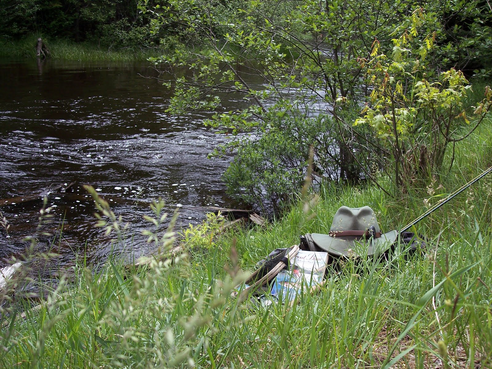
Thursday, September 22, 2011

Night Moves (2 of 7 on the AT)

Many years ago, I spent a week with three friends hiking the 70 miles of the Appalachian Trail in the Smoky Mountains. The four of us spent our fifth night in our old friend, Icewater Spring shelter. I’ve spent more nights in the Smokies in this shelter than anywhere else in the park. It’s also the park’s most heavily-used shelter because it’s only a three mile hike from Newfound Gap, and it can serve as a gateway to a nice hike up Mt. LeConte or to Charlies Bunion.

We slept well that night. Eventually…

When Allen started screaming, my response was to hunker down deeper in my sleeping bag, hoping that whatever was killing him would not notice me. After a few seconds I heard Joey talking to him, calming him down. At that point, I realized, through the fog of sleep, that we were not being killed and eaten by a bear. It was one of Allen’s nighttime episodes. I had heard that he sometimes would wake up at night screaming, but I hadn’t experienced it until that night at Icewater Spring. Allen had been my most consistent backpacking partner during that period in my life, but it was times like this that I wondered if maybe we should have put each other through an application process. Question 1: Have you ever backpacked before? (Because you don’t want to have to babysit your backpacking partner.) Question 2: How fast can you run? (Because you don’t have to outrun a bear; you only have to outrun your hiking partner.) Question 3: Do you ever wake up screaming in the middle of the night? (Because I don’t like a wet sleeping bag.)

Nevertheless, we made it through the night just fine. Until the mice started their nightly escapades.

These old shelters are rustic, solid, and secure. Well, they were secure several years ago. Today there’s no front on them, but for many years there was a chain link fence and gate across the front to keep out the bears, which was important because we hikers would hang our food in bags from the rafters. The mice loved it.

There were two approaches to dealing with the mice: deterrence and acquiescence. The deterrence approach entailed using a plastic or metal lid with a small hole punched in the middle. You would slide the lid onto the rope holding your food bag from the rafters. Except for the case of unusually acrobatic mice, the critters couldn’t get all the way down the rope to the food bag. This approach usually worked, but when it didn’t, you’d end up with holes chewed in your food bag and in your packets of gorp, milk powder, noodles, and cheese. Acquiescence meant forgoing the lid and just leaving your food bag exposed and open. It was sort of like going through customs in a third world country. You’d leave a little “gift” in your luggage for the inspector, and he’d let you in. The mice in the shelters operated in the same fashion. You cooperate, the mice get their small share, and everyone parts as friends in the morning.

I finally settled on a combination of the two approaches. I’d use the lid on the rope, but I’d keep my food bag open. If the mouse made it past the lid, he’d have easy access to my food bag, and I’d end up with a corner of my gorp bag chewed but no holes in my backpack or food bag. Not a high price to pay, as long as the mouse didn’t get mad about the lid on the rope and exact his revenge while I slept.

Sometime during the night the skunks made their entrance. They’d usually just wander around looking for food scraps, and when they were finished, they’d leave by whatever hole they had entered. Only once did I have to get up out of bed and let a skunk out the front gate. He needed help getting out and seemed genuinely appreciative for the favor. He didn’t spray me.

That night at Icewater Spring, behind the chain link fence, we were visited by mice and skunks, but no bears. But it did rain, which was perfect percussion music for sleeping. Which we finally did, when all the screaming stopped.
 

Thursday, September 1, 2011

Those Dark, Dirty Shelters (1 of 7 on the AT)


Let’s spend a few weeks talking about the Appalachian Trail, one of America’s best ideas. The AT stretches about 2,170 miles from Springer Mountain in north Georgia to Mount Katahdin in central Maine. You can hike on it for free. For almost its entire length you can hike and camp without any special permits or paperwork – a remarkable accomplishment considering it’s officially owned by the mother of all bureaucracies, the US government. You don’t have to report in to anyone in a uniform or a dark suit and tie. It’s the epitome of life, liberty, and the pursuit of happiness.

Except for the 72 miles of the AT in the Smoky Mountains.

The Smokies are such a revered location among AT hikers that they could easily be loved to death. It’s a Tragedy of the Commons waiting to happen. So, the government has stepped in to stem the tide of mountain lovers.  

Fortunately, the park is administered by what may be the last, sane department of the US government – the National Park Service. I’ve had numerous encounters with park rangers, volunteers, and other staff persons, and 95% of these moments have been pleasant. The good guys haven’t been chased away yet by whatever it is in bureaucracies that squeezes the spark of life out of its employees.  (Now that I’ve said that, I must admit that the folks at our local post office are great, too. One more reason to live in a small town.)

I should also add that there’s a significant group of folks in the Bryson City area who would disagree with my assessment of the NPS – they are mad about Fontana Lake, the Road to Nowhere, restrictions on bear hunting and ginseng digging, and just about anything the NPS does. Some of them are reasonable people and some aren’t. But I digress…

Even the NPS hasn’t been able to avoid that essential part of every bureaucracy – paperwork. To day hike in the park, just find a trail and go. No paperwork, no permission slips. However, if you want to camp overnight in the backcountry, you’ll have to fill out a permit. (No fees yet, but they are talking about it.) When you arrive at the park, you must find a ranger station and spend five minutes filling out an itinerary. That’s it. Five minutes. Stop for a moment and let that sink in. A five minute encounter with the Federal government. To get the full impact of that, stop for a moment and think about what you were doing on April 14.

If you camp on the AT in the park, you’ll be staying in a rock and log shelter with a tin roof. These shelters are heavily used, and they do show some wear and tear, but even the wear and tear is a reminder that you are doing something that people have been doing for several generations. And people will continue to do it long after you are gone. You are a link in a long chain of main crest hikers. It’s enough to tempt you to carve your name on the old log rafters. (Please don’t.)

Several years ago, a guy named Bill Bryson wrote a book called A Walk in the Woods. He and a friend, both novice backpackers, decided to hike the entire AT from south to north. To make a long story short, they limped and whined all the way to the Smoky Mountains. Once there, they didn’t like the “dark and dirty” shelters, so they quit hiking at Newfound Gap, caught a ride to Gatlinburg, ate some cheeseburgers, then drove to Roanoke, VA. They skipped the eastern half of the Smokies, all of Tennessee, and much of Virginia! I was so disgusted that I quit reading. I don’t know and don’t care how the book ends, but I hope at some point they came to grips with the reality that if you hike the AT, you are going to get wet and dirty, and the accommodations are somewhat primitive. That is, after all, the point.

So call these shelters dirty and dingy if you want to. I call them rustic and quaint. Not in an antique shop way. More of an old barn way. They are drafty, uncomfortable, and crude. They have mice and skunks, and an occasional bear. In other words, they are great, perfect – exactly what you’d hope for on a backpacking trip in the mountains.

Tuesday, July 26, 2011

Incompetence Rears its Ugly Head (Again)

In a previous article I pointed out that someone – such as myself – could be “avid” without being competent. I offered a bit of proof, but in case you still are not convinced, I present further evidence.

Keith Oakes and I were night fishing on a river full of big, brown trout, creatures that are notoriously nocturnal. We heard a couple of splashes in the river in front of us, which might have been mice, muskrats, or beavers, or it might have been a trout feeding on a mayfly, so we immediately began casting toward the sounds. Casting a fly is very different from casting a lure with spinning gear. When you cast with a fly rod you typically keep the fly line and fly in the air for several casts as you let out more line, then after 3 or 4 of these “false casts” you let the line go as the fly whips and then floats down to the water’s surface. It’s during these false casts that you are likely to get your fly and line caught in bushes or branches behind you. That’s not at all unusual on wooded rivers.

AuSable River: Waiting for the sun to set

Midnight on the AuSable River, Grayling, Michigan


On one of my false casts I felt my line get caught on something, and I knew I had managed to get hung up on the willow bushes behind me. Then I decided that it must be the end of a long limb because as I tugged gently on the line it wasn’t just stuck, it was jumping around, pulling back. But even that didn’t seem quite right. There was a random sort of tugging to it, sort of a big, wobbling pull. Just as the awkwardness of it was starting to register in my brain, my line took off in a circle around me. Once, twice. I had caught a bat, and it was flying in one direction, which meant that it was wrapping itself around me, which of course meant that it was getting closer to me, like a game of tether ball where the rope wraps around the pole until there’s no loose rope left to wrap.

Well, that’s exactly what the bat did, until it ended up somewhere on my back, squealing and thrashing. Now, I say it was “somewhere on my back,” meaning that it was actually on my back, tangled up in my fishing net which was hanging from my fishing vest, but I didn’t know that at the time because it was dark, and I couldn’t see a thing. He might have been on my hat, or under my arm, or on my chest, etc. etc. And of course, all I could think about was sharp teeth, rabies, and Dracula. The fact that it was dark merely added another level of anxiety and confusion. So I tried to get my vest off, but I had to reach around to the clips on the side to get it off, and for all I knew that’s where the bat was. The squealing and thrashing continued, while I wiggled out of the vest and unwrapped the line from around me. When I finally got the vest off and threw it on the river bank, the bat was gone.


I heard a small splash nearby, so I shined my flashlight downstream and saw the bat on the surface of the water, still kicking, but floating downstream with the current. The Bat Incident was over, and I had survived. The bat, apparently, would not. But let the record show that I had him in my net for a few seconds. I’m sure a few other fly fishermen have hooked a bat, although probably not a lot, since not a lot of guys fly fish at night. But how many of them can say they got the bat to their net and then safely released him as all genteel fly fishermen do? And if he died somewhere downstream, it’s not my fault bats can’t swim.

Keith finally made his way over to me about the time the bat was disappearing downstream. “What’s going on down here? It sounded like a wrestling match. I thought you caught a huge fish, but then everything went silent.”

“Not a fish. A bat.”

“Really? A bat? So that explains all the squealing and crying.”

“Yeah,” I said, “and I think the bat was scared, too.”

So, confine your fishing to fish if you want to. Not me. I’m expanding my quarry. I’m fishing for mammals. Winged mammals. Catch and release only. It’s a sport only a truly avid outdoorsman could appreciate.

Every now and then I catch a fish instead of a bat

Friday, July 15, 2011

An Avid Outdoorsman

Someone once called me an “avid outdoorsman” in public, and I still haven’t been able to live it down. Several of my friends call me an “avid outdoorsman” every chance they get. Of course, it’s important that you understand that this title is intended by them as a taunt, not a compliment. Some exhibit their verbal skills by finding rhymes for “avid” – words like “pallid” or “putrid” – and sharing them with me via email. Thank goodness for the delete button. Occasionally, they taunt me in the foyer at church. While our families are inside praying or singing, I’m in the foyer withering under their relentless verbal attack. We’ve even had some stern looks from bystanders in the receiving line at a funeral. I guess phrases like “old mule” and “girl scout” followed by giggles aren’t acceptable in some venues.


I must admit, I was a little embarrassed by the description – until I looked up the word “avid.” In the dictionary you see words like “enthusiastic” or “zealous.” Words you don’t see are “competent” or “expert.” So, yes, I suppose you could call me avid. But I’d rather you didn’t. My friends would still jump at the opportunity to put me in my place.


Occasionally I’ll do something that fits that definition of “avid” perfectly – that is, enthusiastic but not necessarily competent. The usual result involves me lying flat on my back on a slippery rock or face down in the dirt or neck deep in a river.


Exhibit A: I was recently fly fishing in a local tailwater (the river below a dam and its lake), casting to a rising trout. After about 15 minutes of fruitless casting, accompanied by several changes of flies and leaders, I decided to wade into a different position further upstream from the fish, so I could get a better drift of my fly over the spot where the fish was feeding. I had been standing in the middle of the river, about waist deep, so I moved toward the river bank into what should have been – should have been, but wasn’t – shallow water. Apparently, for no good reason, there’s a hole between the middle and the riverbank. I didn’t know it then, but I know it now.


Half a second after I discovered the hole, I was up to my neck in COLD water. My waders were full of water, I couldn’t touch the bottom, and I was holding my fly rod in my right hand. So I did the only thing I could do – the dog paddle, a splashing, thrashing, noisy dog paddle. I made my way out of the hole and onto shallow ground with my rod still in my hand and my line and fly dangling and jerking downstream. As I was finally able to stand up again, I noticed that my fly line was hung up on something downstream. It felt heavy. Then I noticed that the heaviness wasn’t the heaviness of a log or rock; it was a living heaviness. Yes, it was a fish. A trout. The trout. The same one I had been carefully pursuing for the past 15 minutes.


So, the end of the story is that the only fish I caught that day was the one I caught while doing the drowning dog paddle. Of course, I told Tim and Keith that it was a special technique that I had been working on and had only recently perfected. After all, the books and manuals all say that technique – the word we use in fly fishing is “presentation” – is more important than fly size and style. So, the dog paddle technique is clearly the secret weapon that all fly fishermen are seeking, and now I’ve made it public for the first time. I’m calling it the drowning dog paddle or DDP, for short. I’m sure you’ll be reading about it in Field & Stream in the near future.


It’s something that only an avid outdoorsman, such as myself, could invent.


Thursday, June 16, 2011

One Big, Nasty, Tangled Mess (Part 5 of 5)

Any landslide in the Smoky Mountains will have two parts. The upper portion – the scar – consists mostly of bare rock where acres and acres of soil, shrubs, rock, and trees once resided. The lower portion – the debris field – consists of all those acres of soil, shrubs, rock, and trees, all thrown together into a tangled mess. Those high elevation scars are frighteningly beautiful and make for dramatic pictures. If you want to impress your friends, point to one of these scars on a mountain slope across the valley and tell them you’ve scrambled or slid down it.

The debris field at the bottom of the scar is a different matter. It’s wild and chaotic and not at all photogenic, definitely not postcard material. If you watch the welcome video at Sugarlands Visitor Center, you’ll see images of creeks, deer, mountain tops, and foggy mornings, but one thing you won’t see is a debris field. If the Smokies were a city, a debris field would be a ghetto or maybe the municipal landfill. It’s just not the sort of thing you advertise to the tourists because it isn’t pretty.

Debris fields are also difficult to maneuver because they consist mostly of tangled, criss-crossed trees and piles of rocky dirt. It’s bumpy going with plenty of opportunities to step into a hole or a soft spot or to slip off the tree trunk that you are walking on or climbing over. Then, of course, there are the snakes.


To be honest, I’ve walked through about a dozen debris fields, and I’ve never seen a snake in any of them, but there’s no question in my mind that these places must be full of them. When I’m hiking in the Smokies, I rarely think about snakes and other creepy, crawly things because dwelling on those possibilities would probably get me too spooked to go. So I put them out of my mind. Except, that is, for when I’m picking my way through a debris field. The rattlesnakes I’ve seen in the Smokies are usually lying in the middle of a tangle of rocks and tree branches -- and that’s exactly what a debris field is, multiplied by about 10 gazillion. For that reason, I try to avoid this tangled habitat in warm weather, preferring those cold days that push those cold-blooded critters into dormancy.

 The particular debris field that Greg Harrell and I picked our way through near the bottom of Anakeesta Ridge was impressive in a big, nasty, tangled sort of way. It’s impressive not because of its beauty but because of the sheer power that was required to create it. You can’t look at this sort of scene the way you look at Cades Cove or a sunset. Those sights are breathtakingly beautiful. No, you have to look at the debris field at the bottom of a landslide the way you look at the wreckage after a tornado or a tsunami. There’s a mixed sense of sadness and awe at the raw power that was momentarily unleashed to do its destructive work.

 It’s funny, then, that the spot where this mass of wreckage meets Newfound Gap Road at the south base of Anakeesta Ridge appears as a modest, little creek full of broken rock and young, birch trees. You’d never know, as you drive past, that the remnants of a massive, natural catastrophe lie just a few yards uphill from the road, hidden from view. When this landslide happened back in 1984, tons of mountainside were funneled down into a narrow valley and sped down the chute and out onto Newfound Gap Road. Bulldozers and dump trucks did such a good job of cleaning up the mess on the road that the typical car tourist hasn’t a clue that several hundred yards of debris begin just a few yards above the road.

 The best indicator that something out of the ordinary happened is the pure stand of yellow birch trees, all about four inches in diameter, filling up that narrow creekbed. There’s a similar stand of yellow birches along the bottom 1.5 miles of Alum Cave Trail where landslides of 1951 and 1993 both came roaring down the river valley, so apparently yellow birch trees are a pioneer species which specializes in the disturbed soil of a landslide. You can recognize these distinctive birches by their golden, papery bark that peels off in horizontal strips. I would have been tempted to call them paper birch, but my tree books tell me that paper birches don’t live in the Smokies. So these papery birches are actually yellow birches.

 As far as I know, there’s no law against exploring Anakeesta Ridge --- as far as I know – because being firm believers that it’s easier to get forgiveness than permission, we didn’t ask. (And if you don’t get caught, then… well… you don’t have to ask for forgiveness.) Luckily, our national parks really are parks for “the people,” and I’ve been pleasantly surprised at the lack of restrictions on our right to wander in the Smokies. If we had asked permission, we’d have received a brief lecture about safety and discretion, and then we’d have been told to have fun and be careful – which is exactly what we did.

 [There are easier and safer ways to visit landslides and debris fields, places that snakes avoid and rangers approve of: namely, Alum Cave Trail and Road Prong Trail. Both of these are popular and safe, yet challenging and beautiful, and I’d highly recommend them. For more details, visit the end of this article at www.greghoover.blogspot.com.)

Website Only:

A landslide took place on June 28, 1993 in the area called Huggins Hell, located above Alum Cave Trail. This is the same general area where the 1951 slides occurred, so there are still a few signs from the earlier slides, but most of these have been covered up by the passage of time and the more recent slide of ’93. To see part of this landslide, walk about 1.5 miles up this trail until you reach Arch Rock. At this point the trail turns right, crosses the creek (Styx Branch) on a small footbridge, and goes through Arch Rock. Before you cross the footbridge to enter Arch Rock, take a brief side trip by bearing to the left on the narrow path. You’ll only need to walk about 20 feet up this trail, then stop and look at the thin forest (yellow birch) up the slope, then look at the lumpy ground you are standing on, then turn around and look back down the trail and river valley that you just walked up. You are actually standing in the middle of the old, 1993 landslide debris field, full of yellow birches.

Now backtrack a few feet and follow the trail through Arch Rock and continue for about five minutes. You’ll cross Styx Branch again on a small footbridge, and within a couple of minutes you’ll cross a rocky creekbed that is not really a creekbed. (Although, it may have water running in it after a rainy spell.) It’s the scoured out path of the 1993 landslide that you were standing in five minutes ago. To see a little more you can walk five minutes uphill on this rocky route, then walk back downhill across the main trail. After about 10 minutes of walking down this rocky, messy route you’ll find yourself back at Arch Rock. You’ve been exploring the path of that 1993 landslide, a tangle of rocks and trees. This landslide consisted of a section of land about a quarter mile long and twenty feet deep sliding down into the Styx Branch riverbed, then Alum Cave Creek, and ending at Newfound Gap Road. In other words, your entire hike today has been in the path of a landslide. Before you leave Arch Rock, look downstream. Most of the trees in the creek valley are small birches that have sprung up since 1993. You probably didn’t notice that fact as you walked up the trail at the start of your hike; now, on your return trip, those young birches will be obvious and will accompany you all the way back to your car. Also accompanying you along the way are occasional lumps and gullies. Several places in the last mile down to your car, you’ll notice that the river is to your left and another ravine runs parallel to the trail to your right. This ravine and the rough embankment between you and it were all a part of this debris field.  


For good, up close views of landslide scars you’ll need to continue up Alum Cave Trail all the way to the top of Mt. LeConte. The top mile or so of this great, great trail will take you across several rocky scars, both old and recent, some overgrown with grass, some still bare. (The views from the top of LeConte are icing on the cake that makes this trail doubly worth the effort.)


Another landslide was the result of Hurricane Opal in 1995. This landslide is better known to hikers than drivers because no roads were affected. The Road Prong Trail is squeezed between Mount Mingus and Sugarland Mountain, just south of the Chimney Tops. Near the top of this popular trail, about a mile below the ridgecrest, there are very obvious, visible remnants of this event. There are large tangles of trees and rocks on both sides of the trail – and above the trail. There is one point where a tangle of large trees spreads over the creek and trail like a bridge. If this had been a road, the wreckage would have been cleared away quickly by chainsaws and bulldozers, but because this is a backcountry trail, the remnants of the slide remain.

The only other detail I’ll give about Anakeesta is that the small, inconspicuous creek that is at the bottom of Anakeesta’s 1984 debris field (the one Greg and I scrambled down) is on Newfound Gap Road about 1.9 miles below Newfound Gap. (If you are following the small, brown mile markers from Sugarlands, it would be about 12 ½.) You could park there and hike up into this debris field, the main risk being slippery rocks – although I’d do it in cold weather to avoid any unwanted encounters with snakes. There’s a good story about this 1984 landslide in Smokies Life Magazine, Vol. 1, No. 1. It’s sold in most of the visitor centers in the park.
 

Thursday, May 26, 2011

An Old Landslide From Top to Bottom (Part 4 of 5)

If you stop near Morton Overlook about a mile below Newfound Gap, across the valley to the north you’ll see Anakeesta Ridge. On the right (east) end you’ll see two peaks. The right peak is Anakeesta Knob at the easternmost end where Anakeesta Ridge converges with the Boulevard near Mount Kephart. The left hump is the place where our morning route along a nameless side ridge reaches the main crest of Anakeesta Ridge. You’ll also see that most of the trees and soil to the left of that peak have been shaved off by a landslide. That scar is one of those dangerous, vertical scars that could be deadly, but a few hundred yards to the left (west) there is a low swag in the ridge. Greg Harrell and I worked our way along the ridgecrest to that swag, had some lunch, and began to wonder…  would it be really, really stupid to scramble down one of these rocky scars?

After letting that thought simmer for a while, the answer became obvious to both of us. One of our reasons for coming to Anakeesta had been to see the landslide scars up close. Finding a route down one of them would probably be interesting, maybe educational, and definitely up close. So that’s what we did, and as you can see, we lived to tell the tale.

At the low swag in the ridge where we were having for lunch, the landslide scar looked less treacherous. I’d guess it was at least a 45 but not quite a 60 degree angle; not easy, but far from vertical. In fact, along the western edge of this scar, a small forest of young trees and bushes was growing up. About 25 years worth of leaves had begun to create a layer of soft dirt that actually made walking pretty easy.

So we left the ridgecrest at the swag and angled our way through this young forest, down the slope, and to the bare rock scar. Once we reached the bare rock below the crest, we gingerly worked our way down the scar. In situations like this, I tend to be a bit more cautious than Greg. He says I’m a sissy. I say he’s too stupid to be scared. We’re probably both right. So I crab-walked down the scar on all fours with my butt dragging the ground as an emergency brake. It’s a slow process, but that’s sort of the point. Thus, we both managed to travel down and across several rocky scars with a few, small bumps and bruises but no near-death experiences.


In most places these scars are barren and still crumbly. In other places there are long cracks in the rock that have filled with dirt and have sprouted various species of shrubs. I would guess that 100 years from now, this will be another Smoky Mountain heath bald – one of those smooth-looking evergreen swaths that punctuate high, rocky ridges. It was a perfect laboratory for what we’ve all learned in school – that given enough time, a rocky surface will turn into a forest or field (or, in this case, maybe a heath thicket). If I were a young biologist, I’d study these scars on Anakeesta Ridge to track their progress. I suppose it would be a rather long, drawn-out project that would outlive several generations of researchers, but it would beat sitting in a laboratory watching petri dishes.


So we zigged and zagged our way down the barren slope to lonely outposts of vegetation that would provide a chance to stand up and walk a few yards. There were also a few small ridges that had their sides scoured by the landslide, but their crests were still covered with small trees and shrubs. All in all, the terrain was scrubbed and sterile, with occasional islands of life scattered about. I guess it’s really just a large version of a driveway or sidewalk – mostly clean and well-swept, with the occasional dandelion or tuft of grass poking up through the cracks.


After an hour or two of scrambling and exploring these rocky acres, we entered phase two of the landslide – the debris field. All the stuff that had once been high on the mountain slope now formed a tangled mess below. [To be continued]

Tuesday, May 3, 2011

Place of the Landslides (Part 3 of 5)

Our hike to the top of Anakeesta Ridge would be steep, ascending 1,000 feet vertical in 3/10 of a mile horizontal. It wasn’t dangerous, but it was dirty, tiring, and slow. Greg the Statistician told me the next day that this was the slowest hike we had ever done. We covered one mile in five hours; although, in our defense, there were more than the average number of stops for pictures which is a sure sign of a memorable trip.
 
There was a lightly worn path running right up this narrow crest, meaning that this route was occasionally used by others. Who these others are and how they discovered this route are mysteries to me; although, I have a hunch that not all of them are human. Sometimes a path is clear from head to foot, but others are only about knee high. Those knee high tunnels through the brush are almost certainly bear paths, which adds another layer of drama to the trip. Walking on a trail is fine. Walking on a manway has a greater sense of discovery to it. Walking on a bearway is wildly enticing, as long as the bear is black, not grizzly.

Whoever they are, human or ursus, they keep their secrets well, and I found myself thanking them for their covert trailblazing. Pushing one’s way through a pathless tangle of rhododendron and mountain laurel is the hardest, most frustrating part of off-trail hiking. Yes, off-trail hiking is a lot easier when there’s a path… and I’ve been surprised at how often there is one.

On the other hand, the presence of rhododendron, mountain laurel, and sand myrtle means that you are in a beautiful, wild place that becomes outrageously beautiful in May, June, and July. In fact, when it’s all said and done, I think these lonely, rocky, narrow ridges covered in heath thickets are my favorite places in the Smokies. There’s always a good view of the surrounding terrain, there’s always work and sweat involved which makes the destination all the more special, and there’s a gradual progression of spring blooms which is so outrageously outrageous, so extravagantly extravagant, that redundancy is necessary but not quite sufficient.

After about two hours of hiking, scrambling, and picture-taking, Greg and I reached Anakeesta’s main crest, and we found the spot where a month earlier we had taken a wrong turn and stumbled upon this side ridge. We followed the faint trail leading west along Anakeesta’s crest, giving magnificent views across the Alum Cave and Styx river valleys. The broad crest of Mount LeConte was visible: Myrtle Point, High Top, Cliff Top, West Point, Balsam Point. Looking down we could clearly pick out Alum Cave Trail leading to Inspiration Point and Peregrine Peak. There are many reasons why people hike, but views like this are high on everyone’s list. It’s good to know early in the day that your hike has paid off handsomely in the form of vast panoramas, and this one had. If we had quit right then, the hike would still have been a success.


But the really unique part of this hike was yet to come: the landslides.


There have been several large landslides since the park was established in 1934, and numerous smaller ones. A storm on September 1, 1951 and another on June 28, 1993 struck the south slopes of Mount LeConte around Peregrine Peak. From our vantage point on Anakeesta Ridge, rocky scars from these downpours and subsequent landslides were clearly visible high on the south slopes of Mt. LeConte.

Another large landslide was actually a pair of landslides that occurred on August 10, 1984. After a heavy, evening thunderstorm two sections of mountainside slid off the southern slope of Anakeesta Ridge and onto Newfound Gap Road, between Alum Cave Trail and Newfound Gap. About 30 cars were trapped on the road between these two slides for several hours. Amazingly, while there were several near-misses, no one was seriously injured. These are the prominent rocky scars that are visible from the Morton Overlook parking pullouts. It was these scars that we were walking above today.

My wife is skeptical when I tell her this, but it’s true: those rocky scars are not quite as dangerous as they appear. Looking at them from a mile away, they look slick and vertical, but as we walked on the ridge above them we could see that some spots were dangerously vertical, but plenty of others were not. Many of these scars had small shrubs beginning to repopulate their cracks and gullies. In fact, small spruce forests were developing along the edges of these scars where there was enough soil to support trees.


As the day wore on, Greg and I began to ask each other what our plans were. We had originally thought that we’d hike along the ridgecrest, enjoy the views, and be flexible. We might follow the entire crest all the way to the Alum Cave Trail parking area. Or, we might hike down some other side ridge or creekbed. But as we looked down the rocky scars we began to consider another possibility: would it be really, really stupid to scramble down these rocky scars? And if so, should that stop us? [To be continued]